Centennial Challenge: Acadia National Park

acadia-cadillacmt

Cadillac Mountain North Ridge Trail, Acadia National Park, September 2016

“People have been drawn to the rugged coast of Maine throughout history. Awed by its beauty and diversity, early 20th-century visionaries donated the land that became Acadia National Park. The park is home to many plants and animals, and the tallest mountain on the U.S. Atlantic coast. Today visitors come to Acadia to hike granite peaks, bike historic carriage roads, or relax and enjoy the scenery.” (NPS, 2016)

In September, on the spur of the moment, we flew to Acadia National Park, located on the Mount Desert Island part of “Down East” Maine. Transported from Bangor International Airport by Woody, our witty and knowledgeable cab driver, we arrived shortly after midnight in Bar Harbor, a charming town that neighbors the park on “The Lobster Coast.”

On the first day, we rented bikes and caught the free shuttle at the central Village Green park, where we visited nearby restaurants, a brewery, coffee shop and an ice cream parlor as well a bookstore, theatre and a museum. Starting from Eagle Lake in the park, we biked 15 miles over the rustic carriage roads developed by John D. Rockefeller. On the ride, we witnessed horse-drawn carriages as we weaved over bridges and around the mountains and valleys to the Jordan Pond House, our half-way destination.

img_1495

“The Bubbles” above Jordan Pond, Acadia National Park, September 2016

From the house, we hiked on the Jordan Pond Path through the forest to Jordan Pond Carry; one of Acadia’s oldest trails that traverses between Pemetic Mountain and the formations called “The Bubbles.” Our route took us to the South Bubbles summit (766-ft.) where Bubble Rock, a large boulder carried by glaciers, sits precariously on the edge of a cliff. Next we back tracked to the North Bubbles summit (872-ft.) before returning on the path to the west of the pond for our bike ride home.

On the second day, we visited the eastern and most popular side of the park. The NPS offered a car-free morning that made for a serene hike on the North Ridge trail to Cadillac Mt. (1522-ft.), named after the French explorer, and later founder of Detroit, Michigan, Antoine Laumet de La Mothe, Sieur de Cadillac. The trail ascended slowly through forest of spruce and pitch pine, gnarled trees, and wild blueberries with expansive northern views at the summit overlooking Bar Harbor, Frenchman Bay and the Atlantic Ocean.

Next we visited Sand Beach on the cool ocean waters before picking up the trail to The Bowl, a picturesque pond nestled between several peaks, including Champlain Mountain, Enoch Mountain, Halfway Mountain, and The Beehive. After nearly being run off the rocky trail by two young, and perhaps foolish runners, we headed past forests, blueberry bushes and remnants of a 1947 fire to the granite summit of Gorham Mountain that overlooks Newport Cove and Otter Cliffs along the coast. On the descent, we detoured at a plaque that marks the Cadillac Cliffs Trail and honors Waldron Bates, who built many trails at Acadia with stone stairs and iron rungs along granite ledges and cliffs.

img_1648

Bar Harbor View & Cadillac Mountain Bar Island, Acadia National Park, September 2016

The end of the trail intersects with Park Loop Road and the Ocean Path trail, which we took north to Thunder Hole and Monument Cove, before a brief respite to soak in the extraordinary crashing waves and backtracking south to Otter Point and views of Cranberry Isles and Baker Island. Exhausted, but needing only two more miles to complete our yearlong national park journey, we flagged down the shuttle and returned to Bar Harbor for our final hike to Bar Island. We crossed the natural land bridge, accessible only during low tide on Frenchman Bay, passing several sea stars until reaching a footpath that climbs through the woods to the interior of the island and views of Bar Harbor and Cadillac Mountain in the distance – a fitting end to our centennial challenge.

The centennial of the National Park Service inspired us to explore 100 miles of trails in national parks. Along the way we met several amazing people who help to preserve and promote the natural beauty of the parks. We learned about the natives and the pioneers who lived on the natural and historical lands and the citizens and politicians who later protected them. From intimate views of wildflowers and wildlife to panoramic views of mountains and valleys and from gentle bikes ride on soft, crushed stone to a strenuous climbs over snow-covered granite rocks, we experienced an extraordinary journey of both natural and self-discovery. Thank you National Park Service and Happy 100th Birthday!

Centennial Challenge: Cuyahoga Valley National Park

ShIMG_9834aped by man-made and natural forces, the Cuyahoga Valley National Park is a story of formation, reclamation and preservation along 22 miles of the Cuyahoga River between Akron and Cleveland, Ohio. Ancient bedrock, glaciers and rivers carved out the diverse and rugged terrain creating barriers for exploration and development of the rich wilderness. In 1832, the Ohio & Eric Canal opened up the frontier for settlement and commerce that improved quality of life throughout the region. For more than a half a century, newly created towns thrived from the emerging industry and technology generated by the canal, that is until the Valley Railway brought about its decline and a 1913 flood essentially washed the canal and dependent industry away. Industry in the cities of Akron and Cleveland would survive and the valley, protected by newly established metropolitan parks, became a recreational escape for urban dwellers. The industrial and residential sprawl by the 1940s, however, overwhelmed the rural landscape and decades of pollution dumped into the Cuyahoga River caused environmental destruction including the infamous fire of 1969 that incited a national outrage. Out of the combustion emerged environmental and social change that led to the creation of the Environmental Protection Agency (1970), and the establishment of the Cuyahoga Valley National Recreation Area (1974). In 2000, through the sustained efforts of several organizations and people to further preserve the land, 33,000 acres surrounding the river became part of the Cuyahoga Valley National Park (CVNP).

IMG_9721

Blue Hen Falls, Cuyahoga Valley National Park

In April, Theresa and I visited a few of the natural and historic sites of the CVNP that stand out along the more than 125 miles of trails winding through deciduous forests, wetlands and agricultural fields. We arrived on a Saturday evening in time to explore the sandstone cliffs known as Ritchie Ledges before joining the lively crowd gathered at the Ledges Trail Overlook to absorb the colors of the sunset across the valley. Although we bypassed the historic park lodging for more modern accommodations in nearby Richfield, the proximity still allowed for a peaceful early morning hike on the Buckeye Trail to Blue Hen Falls, and beyond to Buttermilk Falls. Filled with delightful discoveries of native wildflowers coming to life in the morning sun and fascinating crevices in the sandstone and shale cliffs near the cascading waters of Spring Creek, this trek turned out to be a favorite of our brief 5-miles covered on foot.

Theresa and I followed the trail back along I-271, one of two interstates that strangely bisect the park, and stopped at Boston Mills Visitor Center to learn more about the history of the valley. After a brief look at the adjacent art gallery set in a former 1940s gas station, we headed east on the Stanford Trail to the Brandywine Gorge Trail where a downed bridge forced a precarious passage of the roaring creek on the way to Brandywine Falls. We stopped at Fishers Café and Pub for a much-needed respite before our afternoon 15-mile bike ride on the Ohio & Erie Canal Towpath Trail. The afternoon ride included a brief interlude on the Cuyahoga Valley Scenic Railroad where we had an enlightened conversation about the park with a summer volunteer. Along the trail we passed, among other attractions, the remnants of Jaite Mill and Johnnycakes Lock, wetlands of Stumpy Basin and Beaver Marsh, historic structures such as Everett Road Covered Bridge and Hunt Farmhouse and wildlife by the Bath Road Heronry and the Cuyahoga River.

More than two million people visit the CVNP every year, supported largely by the nearly five million people living within a 50-mile radius of the park and connected National Heritage Area. Located less than a 3-hour drive from Plymouth, Theresa and I will likely visit again to explore and learn more about the park’s past and future growth.

Centennial Challenge: A Yearlong Exploration of U.S. National Parks

npscentennialshirtIn the 19th Century, the American wilderness, celebrated in art, literature and photography, became a source of national pride. Eastern scenic areas like Niagara Falls and western landscapes such as Yosemite, the Grand Canyon, and Yellowstone, became places the public wanted to observe for themselves. While rare at first, tourism to these natural wonders grew with the expansion of the railroad and later with the invention of the automobile. The increased visitation, and subsequent development, however, created a new challenge of how to simultaneously preserve, promote and provide access to the unspoiled wilderness. In 1916, over a half-century after the first land protection law, the National Park Service (NPS) was established “to conserve the scenery and the natural and historic objects and the wild life…for the enjoyment of future generations.”

In this centennial year, Theresa and I plan to explore 100 miles of National Park System trails across the country. The seeds for our planned travels were likely planted over the last two years when we enjoyed remarkable hikes through the varied terrain and ecosystems of the Joshua Tree NP, Isle Royale NP, Indiana Dunes NL and Pictured Rocks NL. Picturing these adventures and my childhood family vacations to the Grand Canyon, Yosemite and Muir Woods, bring to life their majestic beauty afforded to us by the geological processes that created them and the pioneers who protected them.

Today, the increasing threats that endanger the parks, including climate change, whether man-made or not, has also motivated Theresa and I to visit as many national parks as we can fit in this year ‘before they’re gone.’ Our ambitious itinerary includes six National Parks: Rocky Mountain, Cuyahoga Valley, Shenandoah, Olympia, Mount Rainier, and North Cascades. Through these adventures we hope to share the splendor of each place as well as our connection with nature and each other.

Glorious and Free

Wheatley Provincial Park

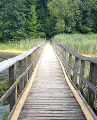
Boosey Creek Footbridge,
Wheatley Provincial Park

Wheatley, Ontario, Canada, July 2014 – In 1870, almost a hundred years after the Declaration of Independence was written, the Congress of the United States of America recognized the Fourth of July as a national holiday. In 2014, Theresa and I celebrated our nation’s Independence Day by camping in Ontario, Canada.

As the nation prepared for firework celebrations, we packed our gear for Wheatley Provincial Park located near Lake Erie, just north of Point Pelee, the southernmost tip of mainland Canada. We pitched the tent on a peninsula overlooking the marsh between two creeks, the Boosey and the Sugar, names that freely describe our weekend.

By day we hiked along the sandy beach, Carolinian forest and fished with the locals at Wheatley Harbor. Although the yellow pickerel did not bite and the stable flies did, we were cordially greeted by blue herons flying overhead and friendly Canadians carousing by the docks. By night we cooked, stayed warm and gazed at the stars close to our campfire. As we slept, or lay awake, the park came to life with nocturnal visits from “Ricky Raccoon” and a thousand croaking bullfrogs singing until the dawn’s early light.

O’ Canada, oh America, two lands glorious and free.

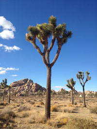
Succulent and Yucca

Joshua Tree National Park Mojave Desert, California

Joshua Tree National Park
Mojave Desert, California

Keeping with the tree theme, my girlfriend Theresa and I visited California’s Joshua Tree National Park last week to appreciate the picturesque landscape and diverse ecosystem. The Joshua Tree is a succulent that grows upward with limbs that diverge with each bloom to create a striking and expressive pose. “The park’s twisted trees, towering rock formations and jumbled geology create a phantasmagorical landscape,” one that if Spanish painter Salvador Dali visited, he might have felt right at home.

While past solo explorations of featured attractions inspired my return to the park, Theresa and I wandered off the recommended path for a more intimate experience with nature. Atop a granite monolith, albeit small, we sensed the energy of the park at its zenith and a peaceful respite from our trekking. We dared not to think of the reported climate change that suggests the end of the Yucca brevifolia, instead immersed ourselves in the beauty of the desert.